Since 2015, the Innovation & Collaboration Centre has supported early-stage startups through providing workspace, mentoring and funding. Read more about our staff and our startups.

Fireflight
 

fireflight

FireFlight was founded in Adelaide in 2018 by Dr Paul Dare (airborne imaging specialist, pilot and ex-firefighter) with the assistance of two colleagues, hardware engineer Greg Davill and software engineer, Dr Simon Cronk. The FireFlight system creates accurate maps of wildfires and delivers those maps in real time to users on the ground.

The goal of FireFlight is to save lives, property and the environment, by providing users with accurate and up-to-date fire intelligence. This information can be used to protect properties, plan firefighting activities, and deploy resources efficiently.

 
  • Reducing the danger posed by wildfires by accurately targeting their location
  • Increasing knowledge of wildfires and fire behaviour
  • Reducing the amount of CO2 entering the atmosphere each year.

The FireFlight system is built around thermal camera and GPS technologies. The system uses thermal cameras (mounted on aeroplanes or satellites) to detect the wildfires, and the GPS to calculate the precise location of those fires. Software onboard the aircraft converts the images to maps and relays them to users on the ground instantly.

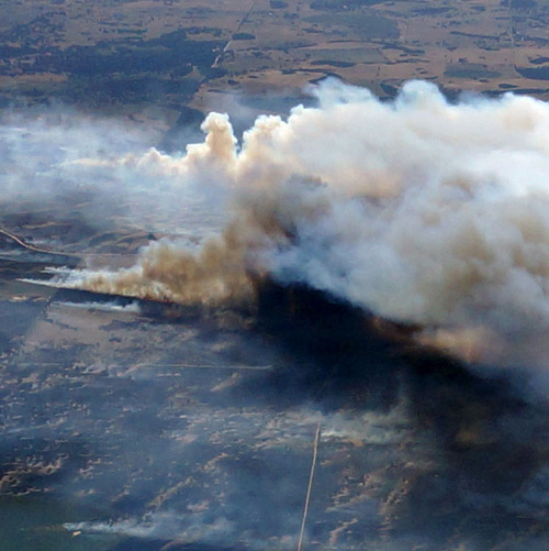
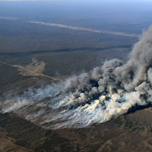
The number and the severity of wildfires increases every year. Wildfires now occur in geographical regions previously thought to be immune, such as the Arctic, northern Europe and northern Canada. In areas traditionally prone to wildfire (Australia, southern Europe, the continental US, South America), the devastation caused by wildfires is becoming increasingly worse.

The FireFlight system can be deployed anywhere in the world where wildfires pose a threat to safety or to the environment. The potential market for the FireFlight system is enormous.

The FireFlight team would like to meet with platform providers/operators, specifically long endurance drones, high altitude balloons, and small satellite operators.

fireflight image Sherwood fire

FireFlight captured images of the 2016 Sherwood Fire using their system built around thermal camera and GPS technologies.


Dr Paul Dare

Dr Paul Dare

Chief Executive Officer

Greg Davill

Greg Davill

Chief Technology Officer
VP Hardware Engineering

Simon Cronk

Simon Cronk

Chief Information Officer &
VP Software Engineering

Brian Harvey

Brian Harvey

Sales Manager

Arnold Fabriczy

Arnold Fabriczy

Web Developer

Nathan De Souza

Nathan De Souza

Research Assistance

Georgina Rawson

Jorgie McKenzie

Office Administration

A launch for space startups

The Venture Catalyst Space program is Australia's first incubator program for startups in the space sector.

Find out more

iccadmin@unisa.edu.au

(08) 8302 7368

South Australian Government

University of South Australia